Buell Center: Omar Ismail and team
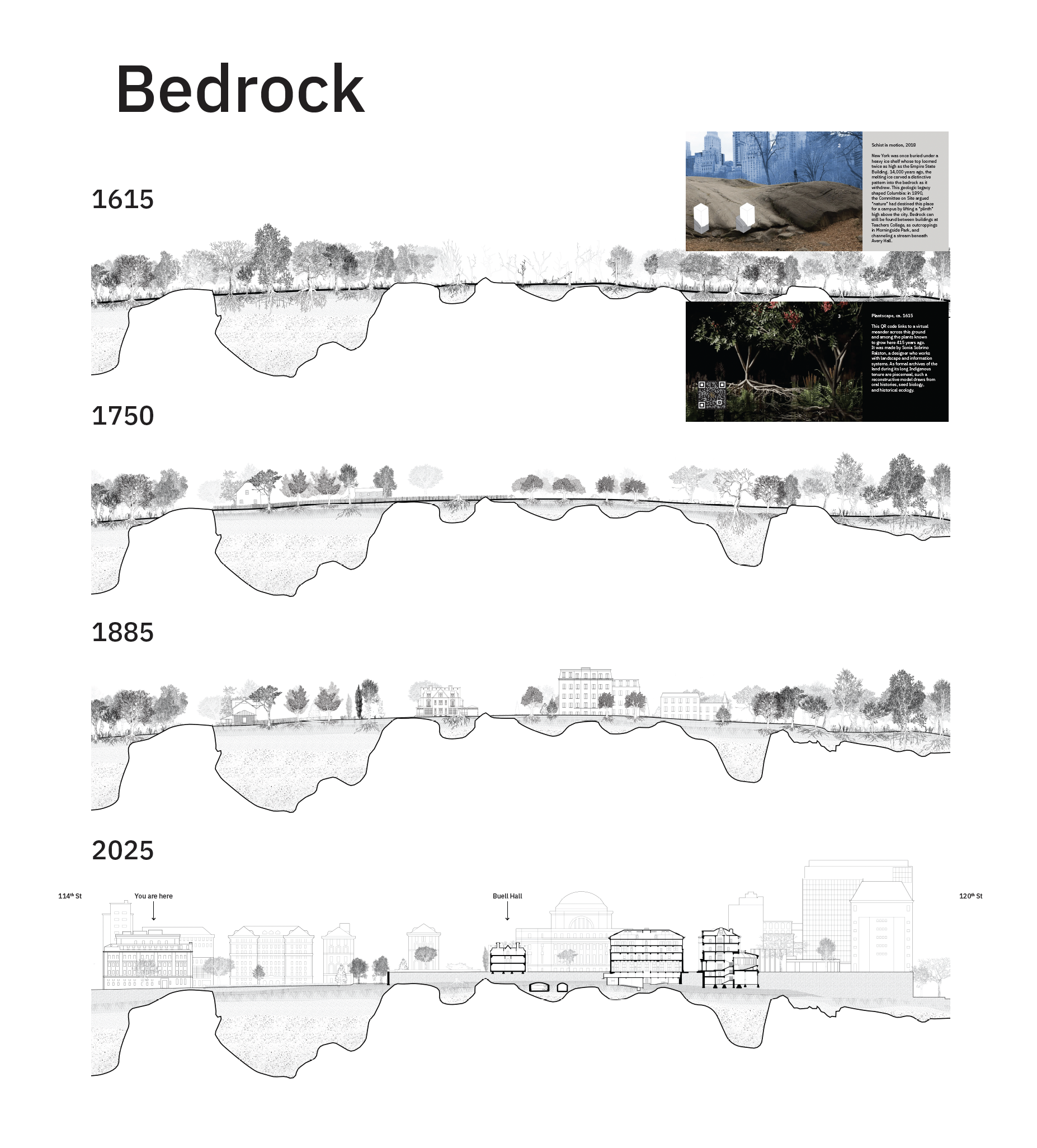
Bedrock
1615. Until the mid-17th Century, the Lenape and neighboring Indigenous nations managed this land’s forests, marshes, tides, storm surges, and its plant and animal communities. By staying seasonally in small encampments, harvesting crops, hunting and fishing, and periodically setting fires to support growth, they maintained an ecology spanning the entire Atlantic Coast. By 1700, these nations had been driven out of their homelands, and while they have established tribal governments elsewhere, they continue to press for return.
1750. A farm stood on this site for much of the 18th Century. Buildings were mostly dedicated to plants and animals, with only a few for human habitation. Monoculture tilled and deepened the soil. Land was allotted, divided and inherited, and eventually sold to two brothers named DePeyster, who co-managed their parcels. Theirs was a gentleman’s farm, where land’s value comes not from sustaining its inhabitants but from producing sellable commodities, including the land itself by keeping it “productive” while anticipating a northward wave of urbanization.
1885. The first institution to consolidate this land into a single campus was the Bloomingdale Insane Asylum, a rural outpost of the New York Hospital established in 1821. Its imposing brick building, with its H-shaped Kirkbride plan, signalled a new era of mental healthcare that prized both science and proximity to agricultural fields, where patients were required to labor as part of treatment. In the mid-19th Century, the asylum began experimenting with a more “domestic” scale of architecture to attract wealthier clients: “villas” surrounded by delicate porches and dedicated staff.
2025. In the 125 years that Columbia has inhabited these grounds, buildings have filled in almost every inch, yet verdant open space remains central to the institution’s identity. Thus, the ground has thickened into a complex infrastructural platform. Columbia’s lawns and plazas sit not atop bare earth, but a cavernous maze of bedrock, fresh water, plant and fungal life, all slowly moving around tunnels, boilers, parking garages, and laboratories.
Schist in motion, 2018
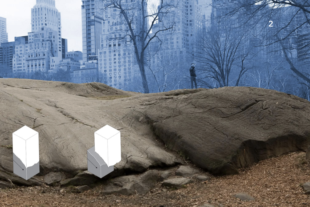
Jason King, “Ice Age: New York” photograph (2018); diagram by Buell Center: Xueyuan Wang with Michelle Huynh Chu
New York was once buried under a heavy ice shelf whose top loomed twice as high as the Empire State Building. 14,000 years ago, the melting ice carved a distinctive pattern into the bedrock as it withdrew. This geologic legacy shaped Columbia: in 1890, the Committee on Site argued “nature” had destined this place for a campus by lifting a “plinth” high above the city. Bedrock can still be found between buildings at Teachers College, as outcroppings in Morningside Park, and channeling a stream beneath Avery Hall.
Plantscape, ca. 1615
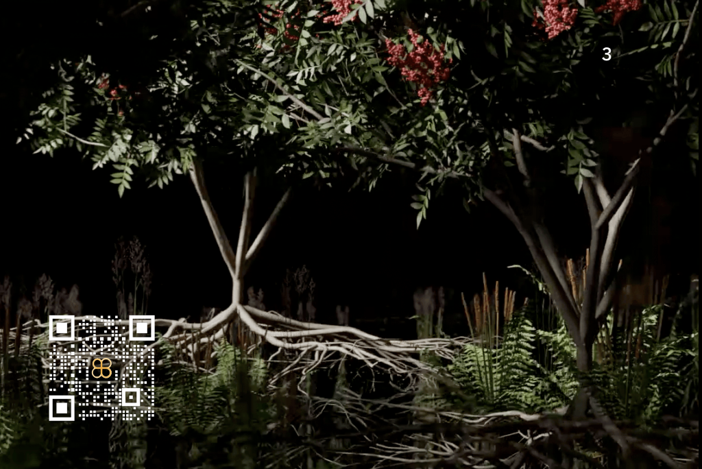
Sonia Sobrino Ralston, AR landscape model (2025)
This QR code links to a virtual meander across this ground and among the plants known to grow here 415 years ago. It was made by Sonia Sobrino Ralston, a designer who works with landscape and information systems. As formal archives of the land during its long Indigenous tenure are piecemeal, such a reconstructive model draws from oral histories, seed biology, and historical ecology.